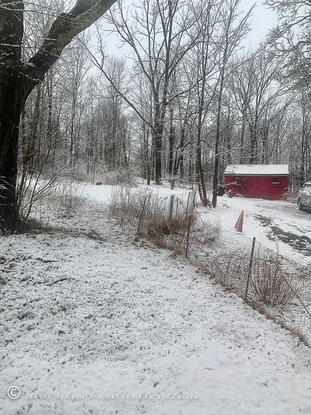
8 am on March 14. We have about a half inch of snow. Rain fell all day yesterday and into the night, so the snow that has fallen so far is heavy and wet. Just after we got up this morning, it changed over into snow.
I’ve been following our local weather gurus and this is a very strange storm. It is shifting east, and some areas east of us, especially on the other side of the Hudson River, will get much more snow than had been expected. Of course, my county includes our local mountain range (the one I see from the front of my house,) and the Catskill mountains, so the more elevated areas will receive a huge amount of heavy, wet snow. Apparently, part of this area is in the ‘downslope’ where much less snow will fall. It looks to me like we are in the downslope. By “much less snow” I mean about 6 inches as opposed to 16 inches. (Downslope has to do with mountains.)
This is supposed to go on until 9 pm. The county has supposedly banned traffic from the roads, but there sure are a lot of cars going by on our county road!
So, in this one county there are huge extremes. The town just north of us has 4 inches on the ground; we have less than an inch.
So far, we have power. But there are outages everywhere. The outage map is full of dots indicating homes and businesses where there is no power.
So far, no winds, but I’m sure they’ll pick up as the day goes on.
I spent a lot of the day yesterday reading the ever-changing forecasts. Such a wide range of predictions! And as new models appeared, the forecast kept changing. It’s fascinating.
Hopefully, we keep our power, but if the amount of snow increases, that might change.
Keep us in your thoughts!
Stay safe.
Happy Tuesday.